Tropical Storm Polo Threat
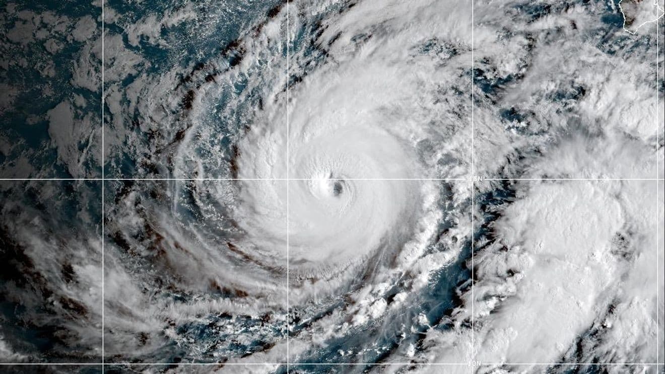
Tropical Storm Polo forms off southwestern Mexico and threatens the coast with rapid intensification.
Anonymous
Key Points
1
The National Hurricane Center said the eastern Pacific hurricane season runs from May 15 through November 30, with activity typically peaking from late June to early October—placing Polo’s formation in a historically active period.
2
At 0300 UTC on September 21, Polo was near 15.1°N, 104.6°W, moving east-northeast at about 4 knots and producing significant wave heights of up to 3.5 meters (11 feet).
3
A specialist marine forecast said Polo could reach hurricane strength within 24 to 36 hours, exceed 100 knots in 48 to 60 hours and potentially reach 115 knots within 72 hours, while warning mariners near the offshore shipping lanes around Manzanillo and Acapulco.
4
AccuWeather rated Polo a 1 on its RealImpact™ Scale for Hurricanes in Mexico and said the storm could bring dangerous surf and heavy rain to Puerto Vallarta and Cabo San Lucas; it also forecast 40-to-60-mph gusts across southern Baja California Sur.
5
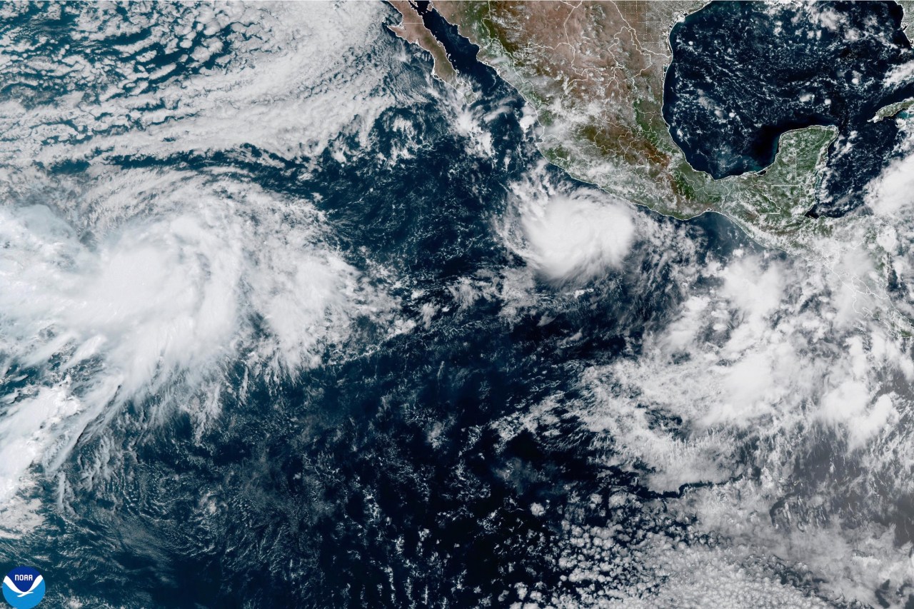
Two other tropical storms were active but far from land: Tropical Storm Fay was near hurricane strength southwest of the Azores but expected to weaken, while Tropical Storm Odalys was far west-southwest of Baja California and forecast to strengthen into a hurricane.
Tropical Storm Polo formed off southwestern Mexico with maximum sustained winds of 40 mph and is located roughly 270 miles south of Manzanillo. National Hurricane Center forecasts rapid strengthening to major-hurricane intensity by midweek as Polo moves eastward before turning north and northwest.
Heavy rain through Thursday could drench Michoacán, Colima and Jalisco, with coastal areas expecting 4 to 8 inches and some spots reaching 12 inches. Wind gusts could hit 80 mph, locally 100 mph. Gringo Gazette reports Polo is the fifteenth named storm of the 2026 Eastern Pacific hurricane season.
Polo Could Become Major Hurricane Within 72 Hours
Watchers News reported Polo had reached 65 mph winds by 09:00 CST on September 21. A specialist marine forecast said the storm could hit hurricane strength in 24 to 36 hours, exceed 100 knots in 48 to 60 hours, and potentially reach 115 knots within 72 hours. National Hurricane Center in Miami confirmed this rapid intensification timeline.
Dangerous Seas and Disruptions Along the Coast
At 0300 UTC on September 21, Polo was producing significant wave heights up to 3.5 meters (11 feet) near shipping lanes around Manzanillo and Acapulco. Mariners in these offshore areas face treacherous conditions. Strong winds and poor visibility will disrupt coastal travel, tourism and marine operations across the region.
Rain, Flooding Risk in Three Key Mexican States
Michoacán, Colima and Jalisco face the heaviest threat through Thursday. Forecast rainfall of 4 to 8 inches with localized totals near 12 inches will create flooding hazards. National Hurricane Center warned that coastal watches or warnings could be issued as the storm's intensity and track become clearer.
Two Other Tropical Storms Developing in the Basin
Tropical Storm Fay is near hurricane strength southwest of the Azores but expected to weaken. Tropical Storm Odalys is far west-southwest of Baja California and forecast to strengthen into a hurricane. AccuWeather rated Polo a 1 on its RealImpact Scale for Hurricanes in Mexico and forecast 40-to-60-mph gusts across southern Baja California Sur.
Sentiment
Mostly NegativeNEGATIVENEUTRALPOSITIVE
Publishers
136
Articles
1.2K
Reach
1.3K
Topics
A
AnonymousAuthor