Devastación en Nepal y Tíbet
Imágenes de satélite revelan la devastación tras el colapso de un glaciar en Nepal y el Tíbet
Anonymous
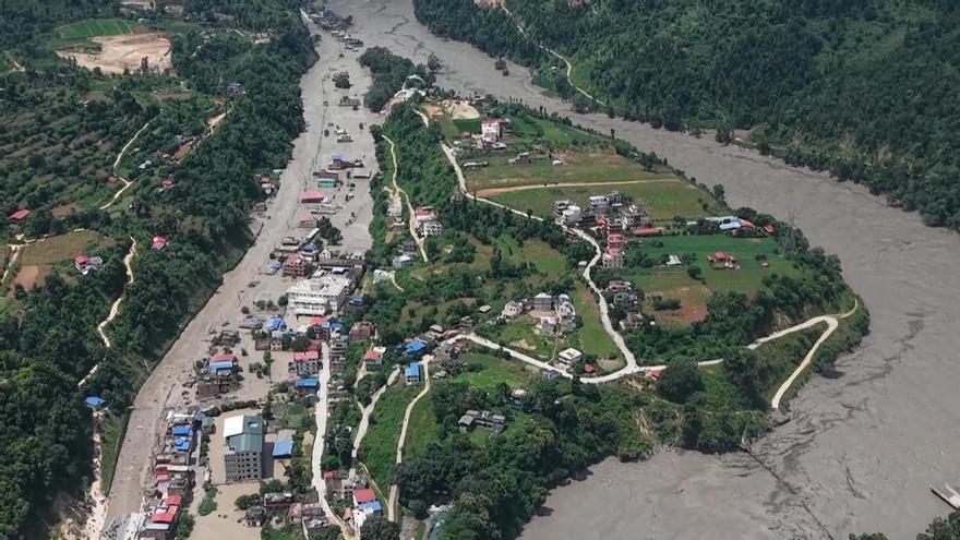
A massive flood swept through Nepal and Tibet on Wednesday after a glacier collapsed, killing at least 359 people and leaving nearly 1,000 missing, according to La Opinión de Murcia. Satellite images captured Thursday reveal the scale of destruction across both regions, showing landscapes completely reshaped by the sudden torrent of water and debris.
A Glacier Collapse Unleashes Deadly Floodwaters
The disaster began Wednesday morning when a glacier in the high-altitude region gave way without warning. The collapse triggered a sudden, violent flood that raced down valleys and through populated areas. El Periódico de Aragón reported that governments in both Nepal and Tibet confirmed the glacial collapse as the cause of the catastrophic event.
Satellite Images Expose the Scope of Damage
Before-and-after satellite photos show the stunning transformation of the landscape. Rivers that once carved narrow paths through valleys now sprawl across wide plains. Entire villages appear erased from the maps. Diario de Mallorca noted that the images captured Thursday highlight entire regions buried under mud and debris from the floodwaters.
Massive Search Underway for Nearly 1,000 Missing
With 359 confirmed dead and nearly 1,000 people unaccounted for, rescue teams face enormous challenges. The terrain is rugged and difficult to reach. Flooding continues to block roads and isolate communities. El Correo Gallego reported that both governments are mobilizing resources to locate survivors buried under the debris or swept downstream by the torrent.
Climate Change Raises Alarm Over Glacier Threats
Glaciers across the Himalayas have weakened significantly due to warming temperatures. Scientists warn that more collapses could happen. LNE highlighted that this disaster underscores growing risks for millions living in valleys below these melting ice fields. Experts say climate change is accelerating glacier breakdown across the region.
Sentiment
NeutralNEGATIVENEUTRALPOSITIVE
Publishers
17
Articles
0
Reach
17
A
AnonymousAuthor


