Fay Nears Hurricane Strength as Odalys Forms
Fay Nears Hurricane Strength as Odalys Forms
Anonymous
Key Points
1
Tropical Storm Odalys was located at 11.1°N, 125.5°W, moving west-northwest at 9 mph with maximum sustained winds of 45 mph, according to the National Hurricane Center.
2
The National Hurricane Center was monitoring at least one additional area of low pressure in the Eastern Pacific for possible development, adding to the region’s unusually high level of activity.
3
NOAA’s Climate Prediction Center said El Niño had a 75% chance of becoming a “historic” event from October through December, up from the 69% probability projected in August.
4
Fay was moving east-southeast at about 5 mph and was expected to turn toward the southwest during Monday before maintaining that general trajectory through the week.
5
Fay fell just short of hurricane strength: the National Hurricane Center reported maximum sustained winds of 70 mph, while the threshold for hurricane classification is 74 mph.
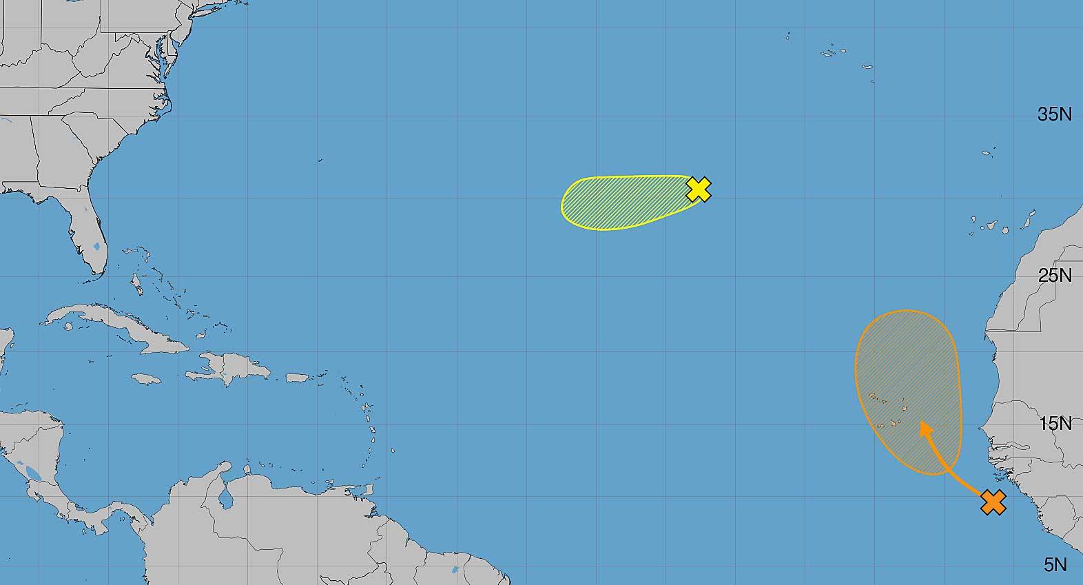
Tropical Storm Fay is nearing hurricane strength over the far northern Atlantic with maximum sustained winds of 70 mph, just 4 mph shy of hurricane classification National Hurricane Center. Located southwest of the Azores, Fay poses no threat to land and is expected to weaken beginning Monday, making it unlikely to become the Atlantic season's first hurricane.
In the Eastern Pacific, Tropical Storm Odalys has emerged as the season's 15th named storm and is gradually strengthening over open ocean southwest of Mexico National Hurricane Center. The unusually active Pacific season reflects strengthening El Niño conditions, while Atlantic storm activity remains relatively quiet.
Fay Falls Just Short of Hurricane Status
Tropical Storm Fay is moving east-southeast at about 5 mph and will turn toward the southwest on Monday, maintaining that trajectory through the week National Hurricane Center. With maximum sustained winds of 70 mph, the storm remains 4 mph below the 74 mph threshold needed for hurricane classification. No watches or warnings are in effect anywhere.
Strong upper-level winds are forecast to weaken Fay starting Monday WJCL, causing it to dissipate by later in the week. The storm's position far from any landmass means it will never threaten U.S. coastlines or populated areas.
Odalys Gains Strength Over Open Waters
Tropical Storm Odalys is located 11.1°N, 125.5°W, moving west-northwest at 9 mph with maximum sustained winds of 45 mph National Hurricane Center. The storm continues to gradually strengthen while remaining completely isolated over the open Pacific Ocean southwest of Mexico.
Forecasters reported no coastal threats from Odalys Bozeman Daily Chronicle. The National Hurricane Center is monitoring at least one additional area of low pressure in the Eastern Pacific for possible development, underscoring the region's unusually high storm activity.
El Niño Driving Exceptional Pacific Activity
NOAA's Climate Prediction Center said El Niño has a 75% chance of becoming a "historic" event from October through December, up from the 69% probability projected in August NOAA. This strengthening El Niño pattern is fueling the unusually active Pacific hurricane season, while Atlantic activity remains relatively subdued.
Separately, the National Hurricane Center is monitoring a tropical wave off the coast of Africa that could form a short-lived tropical depression Orlando Sentinel. The monitoring reflects the continued active conditions across both ocean basins.
Sentiment
Mostly NegativeNEGATIVENEUTRALPOSITIVE
Publishers
15
Articles
214
Reach
229
Topics
A
AnonymousAuthor


