Correcting Global Map Projections
UN General Assembly to Vote on Resolution Promoting Proportionally Accurate World Maps
Anonymous
Key Points
1
The resolution’s backers emphasize that Mercator’s distortion is not just visual preference: it was built to help sailors navigate by keeping lines of constant compass bearing straight, but the map’s enlargement increases farther from the equator toward the poles—making regions like Europe, Russia, Greenland and North America appear larger in relation to equatorial areas.
2
Togo’s Foreign Minister Robert Dussey argued explicitly that “A map is never neutral,” saying it shapes perceptions and can “perpetuate representations that do not correspond to geographic reality,” and he added: “Africa is not asking for preferential treatment.”
3
Dussey said he raised the issue in a briefing to the African Group at the UN, and in that context he did not specify the total number of nations supporting the vote.
4
The African Union’s support for the Equal Earth approach is described as building on earlier work, including promoting the 2018 Equal Earth projection and backing the #CorrectTheMap campaign.
5
Multiple reports tie the vote to a specific date, with the General Assembly vote set for Friday, September 4.
The UN General Assembly will vote Friday on a resolution to replace the Mercator map with equal-area projections that show Africa and other equatorial regions at their true size. CNN reports that Togo and the African Union are leading the push, arguing the centuries-old Mercator projection visually shrinks Africa while exaggerating landmasses near the poles — Greenland, for example, appears as large as Africa despite being 14 times smaller.
The resolution would not ban Mercator maps but encourage governments, schools, and tech companies to adopt more accurate alternatives. Togo's Foreign Minister Robert Dussey stressed that "A map is never neutral" and can shape how people understand the world from childhood, adding: "Africa is not asking for preferential treatment."
How Mercator Distorts the Entire World
The Mercator projection, created in 1569, was designed to help sailors navigate by keeping compass bearings straight on paper. But this method enlarges areas farther from the equator. CNN explains that regions like Europe, Russia, Greenland, and North America appear far larger than they actually are compared to equatorial countries.
Africa's Size Gets Dramatically Minimized
On a Mercator map, Africa appears comparable to Greenland, Russia, and North America combined. In reality, Africa covers about 11.7 million square miles — roughly 14 times larger than Greenland's 840,000 square miles. This visual distortion has persisted in classrooms and atlases worldwide for centuries, shaping how generations perceive continents' actual importance and scale.
Equal Earth Offers Proportionally Accurate Representation
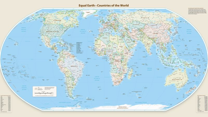
The campaign, called #CorrectTheMap, backs the Equal Earth projection developed in 2018 and other equal-area alternatives. These maps preserve each country's true size relative to others. The resolution would establish more accurate map usage as a new global norm, though existing Mercator maps would remain legal and in use.
Why Geographic Accuracy Matters Beyond Classrooms
Supporters argue that map distortions shape perceptions of global power and influence from childhood onward. Dussey told the African Group at the UN that inaccurate maps "perpetuate representations that do not correspond to geographic reality." Proponents contend fair geographic representation affects how nations understand their place in the world and influences policy and trade discussions.
Sentiment
Mostly NegativeNEGATIVENEUTRALPOSITIVE
Publishers
15
Articles
15
Reach
30
Topics
A
AnonymousAuthor


