Precision Geospatial Mapping
VO305 Series Launches Advanced 305MP Five-Lens Camera for Geospatial Surveying
Anonymous
Key Points
1
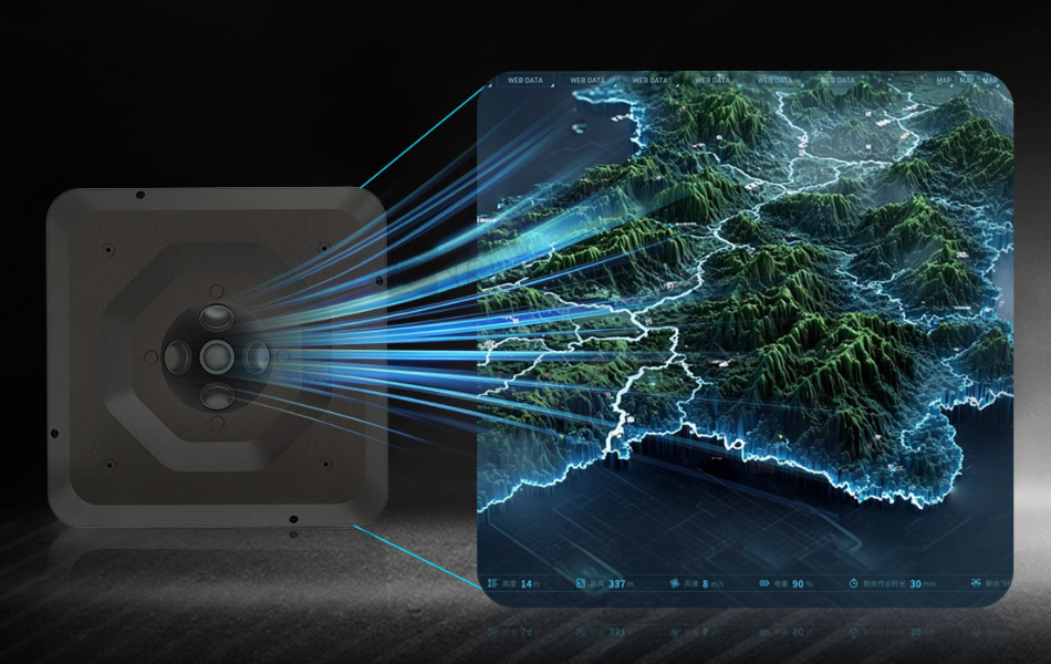
The VO305 Series uses five synchronized 61MP full-frame Exmor R CMOS back-illuminated sensors paired with professional prime lenses, enabling high-resolution imagery from multiple angles in a single flight.
2
In addition to high image quality, the VO305 Series markets higher mapping efficiency and exceptional modeling accuracy for geospatial outputs.
3
The camera configuration captures high-resolution imagery from multiple perspectives in one flight, significantly enhancing 3D reconstruction while reducing flight time and costs for mapping and surveying tasks.
4
The VO305 lineup includes a VO305 Pro model, offering a professional-tier option within the same five-lens oblique platform.
A new five-lens oblique camera system called the VO305 Series is raising the bar for professional aerial mapping. The system packs 305 megapixels of total resolution into a single unit, using five synchronized 61MP full-frame sensors to capture sharp imagery from multiple angles in one flight, according to Financial Content.
The VO305 Series targets industries including urban planning, land surveying, transportation infrastructure, mining, and emergency mapping. A premium VO305 Pro model is also available within the lineup, offering a higher-tier option on the same five-lens platform.
Five Lenses, One Flight, 305 Megapixels Total
The VO305 Series uses five Sony Exmor R CMOS back-illuminated sensors. Each sensor captures 61 megapixels. Together, they deliver 305 megapixels per shot. The sensors are paired with professional prime lenses and fire in sync, capturing ground detail from a center angle and four oblique angles simultaneously, Financial Content reports.
That multi-angle capture is the key selling point. Mapping crews no longer need multiple flights to cover different perspectives. One pass gathers all the data needed for high-accuracy 3D reconstruction. The company says this cuts both flight time and overall project costs.
AI-Powered Brain Runs on Linux With Open Architecture
Under the hood, the VO305 Series runs on a Linux-based AI motherboard. It comes with 8GB of RAM and 32GB of onboard storage. That setup is designed to keep the system stable during long mapping flights and to speed up onboard data processing, according to Financial Content.
The open architecture is a notable feature for professional users. It lets operators build custom workflows on top of the system without being locked into one software ecosystem. This kind of flexibility is rare in dedicated mapping cameras and gives survey teams more control over their data pipelines.
Dual-Channel Control and Wi-Fi Setup Speed Up Field Work
The VO305 Series includes dual-channel camera control, which lets operators manage the system more efficiently in the field. Live status monitoring appears directly on the DJI remote controller interface. Operators can also adjust camera settings remotely through a standard Wi-Fi browser, no extra hardware required, Financial Content reports.
Those field-ready features matter for large survey jobs where time is money. Being able to check system status and tweak settings without landing the drone saves significant time on complex missions like emergency response mapping or large-scale infrastructure surveys.
Target Markets Range From City Planning to Disaster Response
The VO305 Series is built for professional-grade use cases. Urban planners can use it to build accurate 3D city models. Land surveyors get high-resolution data without multiple flight passes. Transportation and mining sectors benefit from precise terrain mapping over large areas, according to Financial Content.
Emergency mapping is also a listed application. In disaster zones, speed and accuracy both matter. A system that can capture a full oblique dataset in one flight pass gives response teams faster access to ground truth data. The VO305 Pro model adds a professional-tier option for teams with more demanding requirements.
Sentiment
Mostly PositiveNEGATIVENEUTRALPOSITIVE
Publishers
10
Articles
3
Reach
13
A
AnonymousAuthor


