Global Storm and Flood Warnings
Severe storms and heavy rainfall threaten multiple regions across the United States and Asia.
Anonymous
Key Points
1
In the Mid-Atlantic, forecasters say the isolated showers and thunderstorms should weaken as they move toward Washington, D.C., and Interstate 95, with no severe weather expected; any heavy downpours are likely to be localized.
2
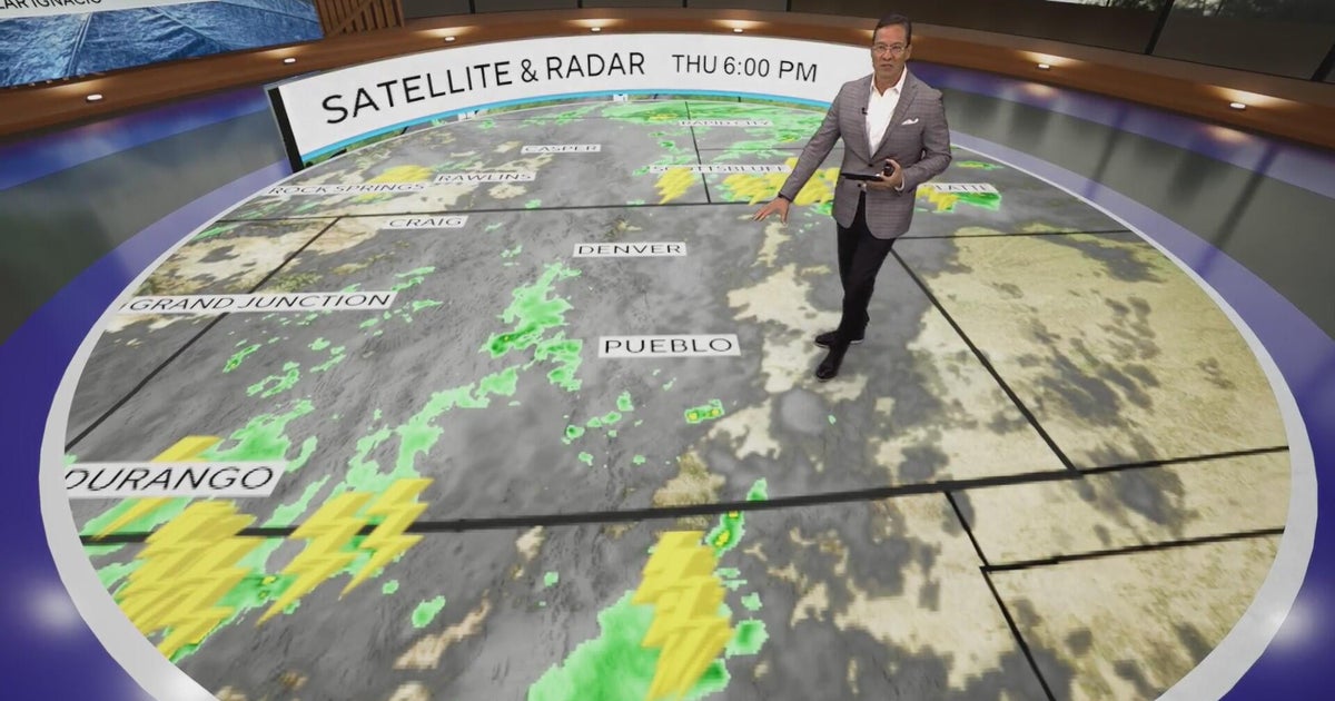
The Sioux Falls area could see thunderstorm rainfall rates of 1 to 2 inches per hour, with the heaviest totals expected northwest of the city; forecasters also noted that fog had developed near Pierre and that drought conditions persisted in parts of KELOLAND.
3
In northeastern Wisconsin, brisk easterly winds with gusts up to 25 mph are expected as rain arrives Friday afternoon and continues into Saturday morning, potentially affecting Friday night high school football games.
4
The Washington-area forecast calls for a relatively pleasant Saturday, with partly cloudy skies and highs near 80 degrees, before Sunday and Monday become the most active and soggy days as another frontal boundary settles over the region.
5
Boston is forecast to turn notably cooler, with a high near 62 degrees Tuesday after a chance of rain Sunday and clearing expected Monday.
Heavy rain and thunderstorms are poised to hammer multiple U.S. regions through early next week, with southeastern Minnesota and northeastern Iowa facing the greatest immediate threat of flash flooding from Friday through Saturday. Across Asia, Himachal Pradesh in India continues recovering from a devastating monsoon season that has killed 296 people and caused losses exceeding Rs 1,661 crore, while northern India braces for additional rain as the monsoon season winds down National Weather Service.
In the U.S., the pattern will shift dramatically. The Mid-Atlantic will see isolated showers Friday before cooler, drier air arrives. Then Sunday through Monday, another weather system will bring wet conditions and temperature drops from Washington, D.C., to Boston Weather Prediction Center. The Kansas City area could see 2 to 6 inches of rain, while Texas faces possible hail, damaging winds, and a very low tornado threat.
Midwest Thunderstorms Threaten Flash Flooding Friday
Southeastern Minnesota and northeastern Iowa face the most dangerous weather this Friday and Saturday, with widespread rainfall of 1 to 3 inches expected and some areas potentially receiving higher totals that could cause flash flooding National Weather Service. Near Sioux Falls, South Dakota, Thursday night will bring heavy rain with thunderstorm rainfall rates hitting 1 to 2 inches per hour. The heaviest rainfall is expected northwest of Sioux Falls, where saturated soil conditions from earlier September will amplify localized runoff and increase flash flood risk Weather Prediction Center.
Northeastern Wisconsin will also see significant rain Friday afternoon into Saturday morning, with brisk easterly winds gusting up to 25 mph. More than an inch of rain is forecast for the region National Weather Service. These conditions could disrupt Friday night high school football games across the area. Drought conditions that had persisted in parts of South Dakota will be relieved by this system, though the intensity of rainfall creates flood concerns rather than relief benefits.
Kansas City and Texas Face Serious Storm Threats
The Kansas City area sits in the crosshairs for heavy rain, with forecasts calling for 2 to 6 inches of precipitation mainly north of the Missouri River Weather Prediction Center. Widespread flooding is possible across the region as a slow-moving cold front collides with warm, moisture-laden air flowing from the Gulf of Mexico. This setup creates "training" thunderstorms — repeated storms passing over the same corridors — that will intensify localized rainfall and runoff National Weather Service.
Texas residents should prepare for multiple threats: heavy rain, possible hail, damaging winds, and a very low tornado threat National Weather Service. New York, Iowa, Missouri, and other states remain vulnerable to storms and localized flooding. The Mid-Atlantic, by contrast, will see isolated showers and thunderstorms that are expected to weaken as they move toward Washington, D.C., and Interstate 95, with no severe weather anticipated.
East Coast Cools Down Before Sunday Storm System
The Washington, D.C., area will enjoy a relatively pleasant Saturday with partly cloudy skies and highs near 80 degrees National Weather Service. But Sunday and Monday will turn active and wet as another frontal boundary settles over the region, bringing significant rainfall and notable temperature drops. Boston will turn notably cooler, with a high near 62 degrees by Tuesday following rain chances Sunday and clearing Monday National Weather Service.
New England is expected to see scattered showers as cooler air moves in. South Florida remains hot and humid with coastal showers, thunderstorms, hazardous surf, and dangerous rip currents. Strong winds are also expected in parts of the northern Plains and James River Valley. Southwest Washington should become sunnier after light rain National Weather Service.
India Battles Continued Monsoon Rains and Damage Assessment
Himachal Pradesh, India, has endured a brutal monsoon season from mid-June through mid-September, leaving 296 people dead and causing losses exceeding Rs 1,661 crore (approximately $200 million USD) Himachal Pradesh State Emergency Operations Centre. The region has suffered 68 blocked roads, destroyed power infrastructure with 142 transformers disrupted, and 129 homes completely destroyed, primarily in the Mandi, Kullu, and Kangra districts Himachal Pradesh State Emergency Operations Centre.
Public Works Department Minister Vikramaditya Singh said the damage "is considerably less" than the catastrophic 2023–2024 monsoon seasons, though losses still hover around Rs 1,500–1,600 crore. Northern India, Delhi, coastal Odisha, central and northern Vietnam, and Himachal Pradesh all face continued rain and thunderstorm risks as the monsoon nears withdrawal Vikramaditya Singh. Additional flooding and storm threats loom across these regions through the monsoon's final weeks Himachal Pradesh State Emergency Operations Centre.
Sentiment
Mostly NegativeNEGATIVENEUTRALPOSITIVE
Publishers
70
Articles
21
Reach
91
A
AnonymousAuthor


