Regional Weather Shifts
Severe Weather and Cold Fronts Bring Major Temperature Shifts Across Multiple States
Anonymous
Key Points
1
Tallahassee-area overnight temperatures could fall into the upper 60s inland across south Georgia by Wednesday morning.
2
Before Utah’s cold front arrives, southwest winds of 15–25 mph are expected Sunday, with gusts potentially reaching 40 mph in western Utah; northern Utah highs should drop into the mid-70s Monday.
3
In Minnesota, Sunday’s high is forecast to reach 71 degrees after showers clear, with overnight lows falling to about 50 degrees in the Twin Cities and the 40s elsewhere.
4
Monday’s Minnesota rain is expected to persist through much of the daylight period, with some showers potentially spreading into Wisconsin during the afternoon.
5
Minnesota temperatures are expected to remain below the seasonal average high of 74 degrees, staying mainly in the 60s from Monday through Wednesday before rising into the lower 70s later in the week.
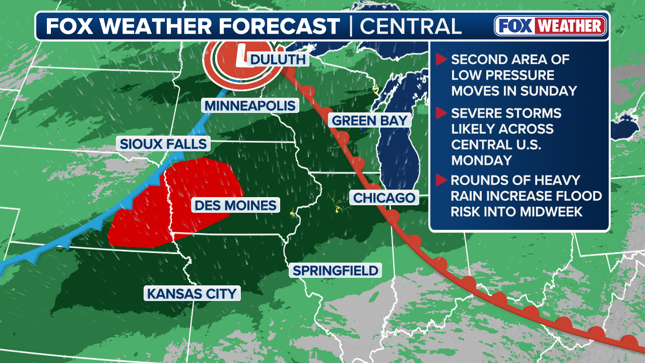
Much of the Southeast and Mid-Atlantic begin the week with drier, sunnier conditions after Sunday's scattered showers and thunderstorms. WTXL reports Tallahassee will see mostly sunny to partly cloudy skies with mid-90s temperatures Monday and Tuesday, followed by a cooldown Wednesday and renewed rain chances Thursday through the weekend. Meanwhile, Minnesota faces a different pattern: widespread rain and thunderstorms with wind gusts up to 40 mph are expected Monday before cooler, mostly sunny conditions return Tuesday.
Tallahassee Enjoys Brief Window of Sunshine and Heat
Northwesterly winds are shifting across northern Florida, transporting drier air and reducing rain chances through much of the week. WTXL indicates Tallahassee will remain mostly sunny to partly cloudy Monday and Tuesday with temperatures holding in the mid-90s. A modest cooldown arrives Wednesday, with overnight temperatures across south Georgia potentially falling into the upper 60s inland—a sharp drop from recent humidity levels.
The break is temporary. Rain chances renew Thursday and persist into the weekend as another moisture plume moves into the region. This pattern mirrors what's happening across Minnesota and Utah, where fronts and moisture patterns shift rapidly between dry and wet conditions within days.
Utah Cold Front Brings Cooling to North While South Stays Wet
A strong cold front will deliver cooler, drier air to northern Utah on Monday, with highs expected to drop into the mid-70s. Before the front arrives Sunday, southwest winds of 15–25 mph will gust up to 40 mph in western Utah, creating a brief period of elevated wind hazards. Northern areas will clear and cool significantly once the system passes through.
Southern and eastern Utah face a different outlook. Lingering monsoon moisture will maintain an isolated flash-flood threat in the southeast and daily showers across eastern portions of the state. This uneven distribution of weather—cooling in the north while thunderstorms persist in the south—illustrates how terrain and moisture patterns can create opposite conditions across short distances.
Minnesota Rain and Wind Precede Mid-Week Clearing
Minnesota will clear and warm modestly Sunday, with highs reaching 71 degrees in the Twin Cities and overnight lows falling to about 50 degrees. However, widespread rain, thunderstorms, and wind gusts up to 40 mph are forecast for Monday, with some showers potentially spreading into Wisconsin during the afternoon. Monday's rain is expected to persist through much of the daylight period, bringing significant moisture to the region.
Cooler, mostly sunny conditions return Tuesday, but temperatures will remain below the seasonal average high of 74 degrees—staying mainly in the 60s from Monday through Wednesday before rising into the lower 70s later in the week. Additional rain chances emerge later in the week as another system approaches, continuing the pattern of alternating wet and dry periods driven by shifting wind patterns and frontal movement.
Why Weather Shifts Rapidly Between Wet and Dry Patterns
When a weather disturbance moves out of a region, northwesterly winds often follow, transporting drier air and reducing cloud formation and rain chances. This temporary improvement explains why Tallahassee, Richmond, and Minnesota all see brief sunny periods early in the week. However, the shift is never permanent because another front or moisture plume inevitably moves into the region, restarting the wet cycle.
Hazards persist even during cool-downs. Lower temperatures do not eliminate risk when rainfall intensity and wind remain significant. Utah's flash-flood threat continues despite the cold front, and Minnesota's wind gusts near 40 mph pose hazards despite highs only in the 60s. Weather safety depends on monitoring moisture levels and wind patterns as much as temperature.
Sentiment
Mostly NegativeNEGATIVENEUTRALPOSITIVE
Publishers
63
Articles
29
Reach
92
A
AnonymousAuthor


