Heavy Rain Threatens Plains
Pacific Moisture and Hurricane Remnants Bring Heavy Rain and Flood Risks Across Plains
Anonymous
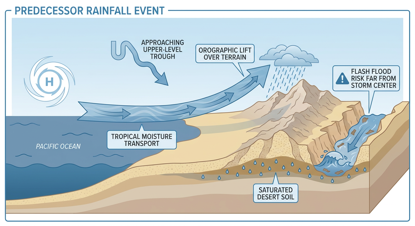
Moisture from Hurricane Polo and other Pacific weather systems is expected to bring several days of heavy rain to parts of the central and southern Plains and southern Colorado, with the heaviest precipitation forecast Tuesday through Thursday. Flood watches are in effect or may be expanded, and localized flooding is a concern; parts of Kansas and the Kansas City region could receive 2 to 4 inches or more, while isolated totals of 3 to 4 inches are possible on the South Plains and the Wet Mountains could receive multiple inches. Isolated severe storms, including damaging winds and hail, are possible in parts of Kansas and Oklahoma. Recent rain has pushed Des Moines’ September total above 13 inches, near its wettest September on record, and more rain could set a new record. Separately, a tropical disturbance near Guam may bring showers and gusty winds later this week, though its track remains uncertain.
Key Points
1
Forecasters attributed the South Plains rain setup to three factors: tropical moisture from the remnants of Hurricane Polo, southeasterly flow drawing in Gulf moisture, and an upper-level low that will help lift the moisture into heavy rain.
2
Rainfall may vary sharply across the South Plains: the northwestern area from near Tulia southwest toward Morton is favored for the heaviest totals, while lower elevations east of the Caprock could receive less than half an inch. Forecasters also warned that nighttime flooding can be difficult to see while driving.
3
Western Kansas was placed in a Moderate Risk for excessive rainfall Tuesday, and forecasters said additional counties could be added to flood watches as rain chances increase.
4
A cold front expected to reach Kansas Thursday evening is forecast to clear the rain and cloud cover, with sunny skies and cooler temperatures in the 70s by Friday and into the weekend.
Sentiment
Mostly NegativeNEGATIVENEUTRALPOSITIVE
Publishers
16
Articles
1
Reach
17
Topics
A
AnonymousAuthor


