Indonesia Earthquake Update
Moderate Earthquakes Strike Indonesia's Sumbawa Region With No Initial Tsunami Threat
Anonymous
Key Points
1
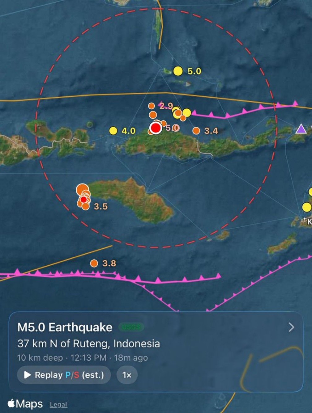
MetMalaysia placed the quake 140 kilometres south of Bima, on the eastern coast of Sumbawa Island.
2
GFZ gave the initial epicentre as 9.69° south latitude and 118.93° east longitude, and reported the quake occurred at 2255 GMT on Saturday.
3
Sumbawa lies in the Lesser Sunda Islands chain, between Lombok and Flores.
4
The article notes that shallow earthquakes can be felt more strongly at the surface because seismic energy travels a shorter distance to reach populated areas; it also describes Indonesia as highly earthquake-prone because several tectonic plates converge around major subduction zones.
A significant earthquake struck Indonesia's Sumbawa region on Saturday evening, with preliminary magnitude readings ranging from 5.2 to 6.0, according to MetMalaysia and GFZ. The quake hit 140 kilometers south of Bima on Sumbawa Island's eastern coast at 2255 GMT. No immediate casualties or significant damage were reported, and MetMalaysia said the tremor posed no tsunami threat to Malaysia.
Sumbawa's Location in Indonesia's Earthquake Zone
Sumbawa Island sits in the Lesser Sunda Islands chain, nestled between Lombok and Flores in eastern Indonesia. The region sits directly above major tectonic plate boundaries. Indonesia ranks among the world's most earthquake-prone nations because several tectonic plates converge around massive subduction zones beneath the archipelago.
Why Shallow Quakes Feel More Intense
The earthquake's depth affects how strongly people on the surface feel it. Shallow earthquakes—those closer to the surface—transmit seismic energy over shorter distances to populated areas. This means shallow quakes often shake buildings and ground more violently than deeper tremors of similar magnitude. Depth estimates for Saturday's quake varied among agencies, potentially affecting felt intensity reports.
Preliminary Readings May Change as Data Arrives
Initial seismic readings from different agencies showed notably different magnitude estimates for the same event. GFZ placed the epicenter at 9.69° south latitude and 118.93° east longitude. As more seismic data flows in from monitoring stations across the region, official magnitude and depth readings may be revised. Final assessments typically take hours to finalize.
Indonesia's Constant Seismic Activity
Earthquakes are routine across Indonesia due to its position on the Pacific Ring of Fire and above subduction zones where oceanic plates slide beneath continental plates. The archipelago experiences hundreds of tremors annually. Most cause little damage, but major quakes—particularly in shallow water—can trigger tsunamis affecting neighboring countries. Saturday's quake adds to Indonesia's ongoing seismic activity.
Sentiment
Mostly NegativeNEGATIVENEUTRALPOSITIVE
Publishers
17
Articles
16
Reach
33
Topics
A
AnonymousAuthor


