Tornado Confirmed Near Francis Peak in Utah
Tornado Confirmed Near Francis Peak in Utah
Anonymous
Key Points
1
The National Weather Service’s preliminary storm report placed the tornado about two miles east of Fruit Heights and said its timing was estimated by comparing radar data with information from the person who posted the video; its location was identified by matching terrain features in the footage with maps.
2
The storm posed a risk of wind gusts exceeding 60 mph, along with ping-pong-ball-sized or half-dollar-sized hail and possible flash flooding.
3
Although the tornado warning expired, a separate Severe Thunderstorm Warning remained in effect for central Morgan County and south-central Weber County.
4
The National Weather Service described the circulation as a funnel cloud observed over northern Davis County before confirming the mountain tornado touchdown.
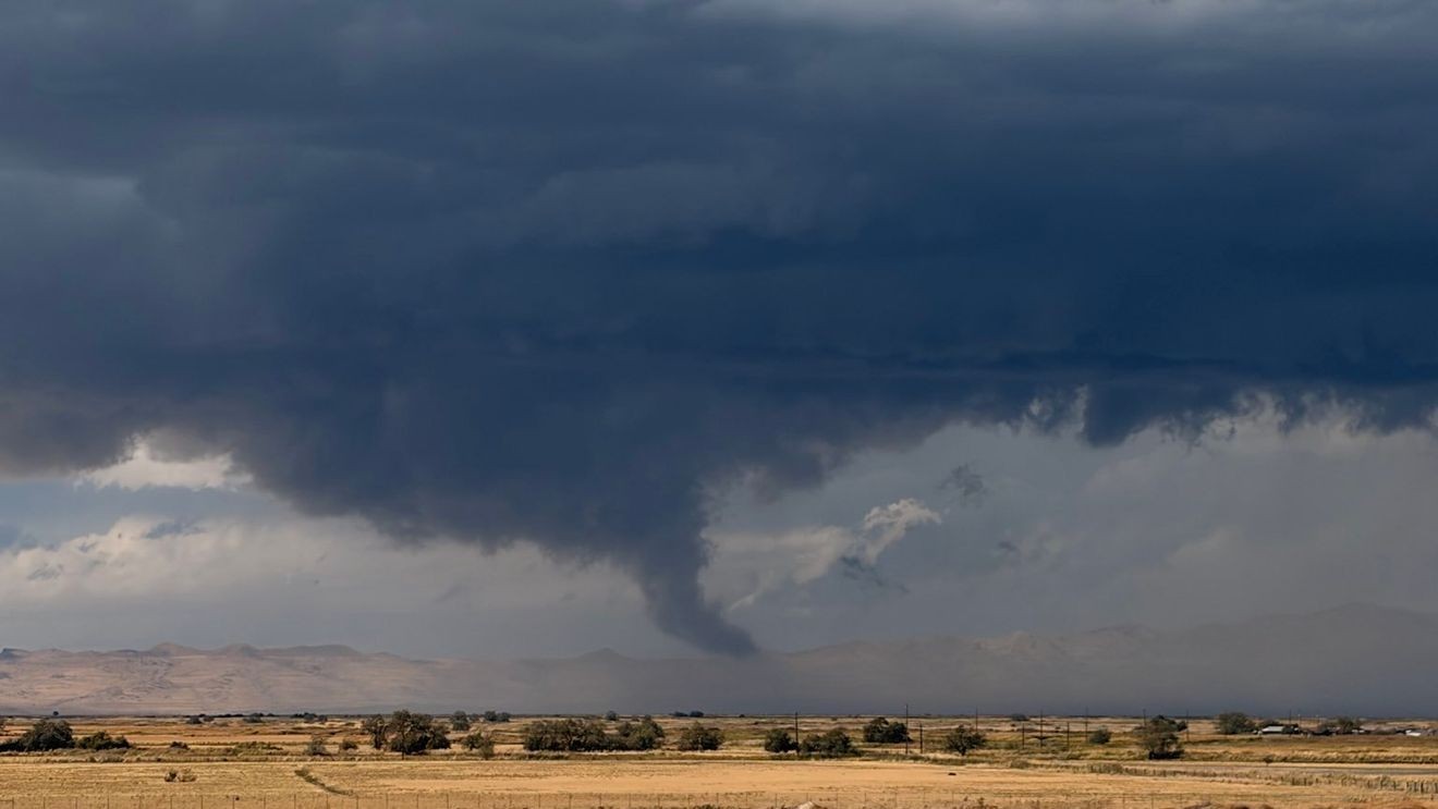
A tornado touched down Friday afternoon near Francis Peak in Davis County, Utah, at an elevation of about 7,500 feet. Local 3 News confirmed the brief touchdown occurred in an unpopulated mountain area east of Fruit Heights with no reported direct damage, though video footage showed visible rotation and debris being lifted into the air.
The storm brought dangerous conditions across multiple counties, including heavy rain, winds exceeding 60 mph, and hail the size of ping-pong balls. Crossroads Today reported that severe weather also caused interior flooding at a Layton Men's Wearhouse store, with water pouring through the ceiling as tornado warnings covered parts of Davis, Weber and Morgan counties until 2:15 p.m.
Mountain Tornado Confirmed at High Elevation
The National Weather Service placed the tornado about two miles east of Fruit Heights at approximately 7,500 feet elevation. Local 3 News noted that forecasters estimated the timing by comparing radar data with video evidence posted by a witness. Storm spotters confirmed the circulation as a funnel cloud over northern Davis County before the actual mountain touchdown occurred.
Severe Weather Warnings Covered Three Counties
Tornado warnings extended across Davis, Weber and Morgan counties, specifically affecting Layton, Kaysville, Farmington, Mountain Green and Morgan until 2:15 p.m. Friday afternoon. The warnings alerted residents in the danger zone to seek shelter immediately in basements or interior rooms away from windows to protect against potential impacts.
Hail and Flash Flooding Impacted Local Businesses
Beyond the tornado itself, the storm unleashed large hail and intense downpours that caused localized flash flooding. Crossroads Today reported that a Layton Men's Wearhouse store sustained damage when water poured through the ceiling during the severe weather event. The National Weather Service warned residents of flash flooding risks and advised sheltering in place until conditions improved.
Severe Thunderstorm Warning Remains in Effect
Although the tornado warning expired at 2:15 p.m., forecasters kept residents on alert with a separate Severe Thunderstorm Warning for central Morgan County and south-central Weber County. The ongoing warning reflected continued storm threats including damaging winds and large hail, even as the immediate tornado threat diminished.
Sentiment
Mostly NegativeNEGATIVENEUTRALPOSITIVE
Publishers
13
Articles
9
Reach
22
Topics
A
AnonymousAuthor


