Severe Weather Alerts
Severe thunderstorm alerts prompt safety warnings across Northern California and Metro Detroit.
Anonymous
Key Points
1
The Siskiyou County storm was tracked near Carrick, about 11 miles north of Mount Shasta, moving northwest at 15 mph; the alert was issued at 4:32 p.m. and was set to expire at 5 p.m.
2
The Humboldt-Trinity storms near Ruth and near Denny were also moving at about 15 mph, with the Ruth-area alert issued at 3:29 p.m. and the Denny-area alert at 3:24 p.m.; both alerts were scheduled to end at 4 p.m.
3
The National Weather Service says about 25 million lightning strikes occur in the United States each year and cause roughly 20 fatalities annually; people indoors should avoid corded phones, electrical equipment, plumbing, windows and doors.
4
Metro Detroit rainfall Wednesday was expected to be limited, with totals reaching about a quarter-inch, while temperatures were forecast to remain in the 70s with humidity fading; rain was likely Saturday and temperatures were expected to fall the following week as fall officially began Tuesday.
5
The National Weather Service’s marginal severe-weather risk is level 1 of 5, with the main thunderstorm windows expected Tuesday morning and again in the late afternoon or early evening as a cold front passes. AAA advised drivers unable to see ahead to pull off safely, exit the interstate rather than stop on the shoulder, and avoid using hazard lights while driving.
The National Weather Service issued short-duration thunderstorm alerts Wednesday across Northern California and warned of severe weather risks in Metro Detroit. Storms in Siskiyou, Humboldt, and Trinity counties threatened pea-sized hail, wind gusts up to 30 mph, and minor damage to outdoor objects, prompting residents near Carrick, Ruth, Forest Glen, Zenia, Hoopa, and Denny to seek shelter. National Weather Service forecasters urged residents to move indoors at the first sound of thunder and wait 30 minutes after the last rumble before venturing outside.
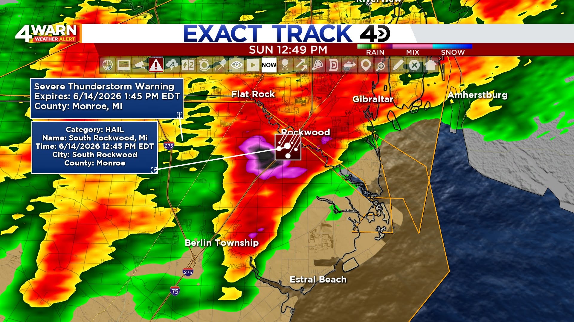
In Metro Detroit, intermittent showers were expected to continue through the evening with overnight thunderstorms possible. National Weather Service placed much of the metro area under a marginal risk for severe weather, with isolated damaging wind gusts, small hail, and heavy rain possible. A wetter, potentially stormy weekend lay ahead as a cold front approached the region.
California Storms Track Northwest Near Mount Shasta
The Siskiyou County thunderstorm was tracked near Carrick, about 11 miles north of Mount Shasta, moving northwest at 15 mph. National Weather Service issued the alert at 4:32 p.m. and set it to expire at 5 p.m. The storms posed a genuine threat to the sparsely populated mountain region during the late afternoon.
Two additional storms developed in Humboldt and Trinity counties near Ruth and Denny, also moving at 15 mph. National Weather Service issued the Ruth-area alert at 3:29 p.m. and the Denny-area alert at 3:24 p.m., with both scheduled to end by 4 p.m. Residents in these remote areas faced the same hazards: hail, damaging winds, and dangerous lightning.
Lightning Safety Remains Top Priority Nationwide
National Weather Service data shows about 25 million lightning strikes occur in the United States each year, causing roughly 20 fatalities annually. People indoors should avoid corded phones, electrical equipment, plumbing, windows, and doors during thunderstorms. The 30-minute waiting rule after the last thunder is the safest approach to outdoor activity.
Outdoor threats extend beyond direct lightning strikes. Pea-sized hail can crack windows and damage vehicles. Wind gusts exceeding 30 mph can topple tree branches and knock over unsecured outdoor furniture. Even minor damage can prove costly during severe weather season.
Detroit Braces for Wet Weekend as Cold Front Arrives
Wednesday rainfall in Metro Detroit was expected to remain limited at about a quarter-inch, with temperatures staying in the 70s as humidity faded. National Weather Service forecasted rain likely Saturday with temperatures falling the following week as fall officially began Tuesday. The marginal severe-weather risk, rated level 1 of 5, centered on two main thunderstorm windows: Tuesday morning and late afternoon or early evening.
AAA advised drivers unable to see ahead to pull off safely and exit the interstate rather than stop on the shoulder. Hazard lights should not be used while driving in poor visibility. Motorists should slow down and increase following distance when thunderstorms approach to avoid accidents on wet roadways.
Sentiment
Mostly NegativeNEGATIVENEUTRALPOSITIVE
Publishers
40
Articles
55
Reach
95
A
AnonymousAuthor


