Weekend Flood Risks
Weekend Storms Threaten Gulf Coast and Florida With Flooding and Dangerous Surf
Anonymous
Key Points
1
In east-central Florida, storms are most likely between 2 p.m. and 8 p.m. through Sunday; stronger cells could bring frequent lightning and 35–45 mph wind gusts. Heat index values may still reach 98–105 degrees.
2
Along Alabama and northwest Florida, surf of 3–4 feet and seas of 3–5 feet are forecast, with moderate to occasionally strong southeasterly winds. Early-morning high tides could push water up to 2 feet above normally dry ground in some coastal spots.
3
The Weather Prediction Center placed parts of the Florida Panhandle at a Level 2 of 4, or “slight,” flash-flood risk for Saturday and Sunday; the risk is expected to ease to Level 1 on Monday.
4
Minor coastal flooding had already been observed in Bay St. Louis, Shell Beach and Grand Isle, though water was expected to recede as the tide fell. In the New Orleans area, the stalled front offshore is forecast to keep small rain chances in the coastal parishes next week.
A stalled weather front sitting offshore is about to dump 2 to 6 inches of rain across the Gulf Coast, Florida, and Southeast this weekend. National Weather Service meteorologists say parts of the Florida Panhandle face a Level 2 flash-flood risk—the second-highest on the four-point scale—as tropical moisture clashes with the stalled front, triggering repeated rounds of heavy storms.
Coastal communities are bracing for dangerous beach conditions, including rough surf of 3 to 4 feet, minor coastal flooding during high tides, and life-threatening rip currents. East-central Florida faces the highest storm odds between 2 p.m. and 8 p.m. through Sunday, with wind gusts reaching 35 to 45 mph and heat index values climbing to 98 to 105 degrees.
Tropical Moisture Fueling Repeated Storm Rounds
The weather setup is straightforward: a cold front stalled just offshore is tapping into abundant moisture from the Gulf of Mexico. This collision creates what meteorologists call "training convection"—storm after storm moving over the same areas. Fox Weather reports that Florida could see 5 to 8 inches of rain in some spots, roughly a month's worth of water in just one week.
In east-central Florida, National Weather Service meteorologists say storms will cluster mostly between 2 p.m. and 8 p.m. through Sunday. Stronger cells could spin up frequent lightning and wind gusts of 35 to 45 mph. Despite the rain threat, afternoon heat index values will still peak near 98 to 105 degrees.
Coastal Flooding Risk Peaks Saturday and Sunday
The Weather Prediction Center placed parts of the Florida Panhandle at a Level 2 flash-flood risk for this Saturday and Sunday. Fox 10 reports that southwest Alabama and northwest Florida are already under Flood Watches. Some coastal areas have already seen minor flooding in places like Bay St. Louis and Grand Isle, though water is expected to recede as tides fall.
During early-morning high tides, water could rise up to 2 feet above normally dry ground in some coastal spots. Surf will build to 3 to 4 feet along Alabama and northwest Florida, with seas reaching 3 to 5 feet. The flash-flood risk is forecast to ease to Level 1 (marginal) by Monday as the front begins to move.
Rip Currents and Dangerous Beach Conditions
Rip currents represent the top weather-related hazard along the northern Gulf Coast, outpacing deaths from flooding, tornadoes, and tropical storms combined. High Rip Current Warnings are active from the Florida Panhandle through Alabama this weekend and extend into Monday evening. Water churning with rough seas and strong winds creates a drowning risk even for experienced swimmers.
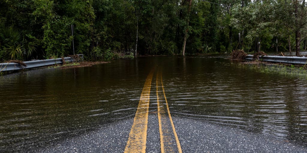
National Weather Service officials urge beachgoers to stay out of the water. The message for drivers is equally critical: "Turn Around, Don't Drown" near flooded roadways. Low-lying coastal roads, especially during high tide cycles, could see wave overwash and minor inundation that makes driving treacherous.
Cooler Weather Arrives Early Next Week
A secondary front will push through early next week, bringing cooler and less humid air to inland areas. However, rain will linger along the coast—particularly in east-central Florida, where wet conditions could persist into midweek. WWLTV notes that the New Orleans area may see only light rain chances in coastal parishes as the front transitions away.
By Tuesday or Wednesday, most of the interior Southeast will dry out and cool down. Coastal zones will take longer to recover, but the back-to-back flood risk will ease significantly after Monday.
Sentiment
Mostly NegativeNEGATIVENEUTRALPOSITIVE
Publishers
48
Articles
29
Reach
77
Topics
A
AnonymousAuthor


