South Florida Faces Week of Heavy Rain, Flooding
South Florida Faces Week of Heavy Rain, Flooding
Anonymous
Key Points
1
South Florida could see easterly winds gusting 20 to 25 mph, while temperatures remain in the upper 80s to lower 90s before the wetter pattern intensifies.
2
Forecasters say the upper-level low over the western Atlantic should approach Florida by late Friday night and then shift into the Gulf over the weekend; cloud cover could limit instability and create uncertainty about Friday’s storm strength.
3
The strongest storms could produce hail in addition to damaging winds and intense lightning, according to the South Florida forecast.
4
A strong onshore flow associated with a large high-pressure heat dome over the eastern United States could drive rainfall rates above 1 to 2 inches per hour across Florida.
5
The FOX Forecast Center projected that Miami could receive 2 to 3 inches of rain through Sunday, with the wet period having begun Wednesday.
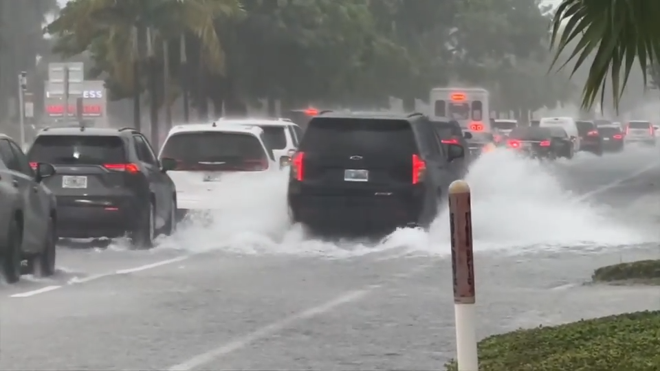
South Florida is bracing for heavy rain and potential flooding this weekend as an upper-level disturbance and tropical moisture sweep across the region. Parts of Broward County already received 3 to 6 inches of rain Thursday morning CBS News, and forecasters say conditions will worsen with rain chances climbing to 70% to 80% through Sunday Space Coast Daily.
Slow-moving storms could dump intense rainfall at rates above 1 to 2 inches per hour, bringing damaging winds, frequent lightning, and flooding to urban and poorly drained areas WLRN. Miami alone could see 2 to 3 inches of rain through Sunday. Despite the dangers, the wet pattern may ease South Florida's ongoing drought.
How Much Rain Will South Florida Get?
An upper-level low moving over the western Atlantic should reach Florida by late Friday night and then shift into the Gulf by the weekend WUSF. The FOX Forecast Center projects Miami will receive 2 to 3 inches through Sunday, with the wet stretch having begun Wednesday. Broader parts of Florida could see several inches across the weekend CBS News.
When Will Storms Peak in Severity?
Friday's storm strength remains uncertain because cloud cover could limit atmospheric instability WUSF. The strongest storms are most likely Saturday and Sunday. They could produce hail, damaging winds gusting to 20 to 25 mph, intense lightning, and torrential downpours WLRN.
A strong onshore flow tied to a large high-pressure heat dome over the eastern United States will drive rainfall rates upward. Temperatures will stay warm—upper 80s to lower 90s—even as the unsettled pattern intensifies into early next week CBS News.
Which Areas Face the Biggest Flooding Risk?
Urban areas and poorly drained neighborhoods are most vulnerable to localized flooding from slow-moving storms CBS News. Broward County has already experienced flooding this week WSVN. With 70% to 80% rain chances through the weekend, waterlogged ground will make streets and low-lying areas susceptible to washouts and standing water.
Will This Rain Break South Florida's Drought?
The sustained rainfall pattern could provide relief from South Florida's ongoing drought CBS News. Several inches of rain across the region through the weekend would meaningfully replenish groundwater and surface supplies. However, forecasters warn that the immediate risk of flooding outweighs the drought benefits—residents should prepare for both dangerous conditions and wet relief.
Sentiment
Mostly NegativeNEGATIVENEUTRALPOSITIVE
Publishers
17
Articles
4
Reach
21
A
AnonymousAuthor


