Diverse Autumn Weather Patterns
Regional Fall Forecasts Bring Cooler Nights, Variable Weather and Early Foliage Changes
Anonymous
Key Points
1
Sioux City had not recorded a temperature in the 40s since June 20 or one in the 30s since May 20, making the forecast overnight lows in the upper 30s to low 40s a notable seasonal change.
2
In west-central Indiana, highs are forecast to reach the mid-80s before a cold front arrives overnight; Friday highs then fall into the 60s, with rain clearing by afternoon.
3
AccuWeather meteorologist Paul Pastelok said the Southeast could see leaves stay green until they drop: “Plenty of clouds and rain will keep the leaves green until leaf drop in the Southeast.” He attributed dull colors to a lack of clear nights and cooler air.
4
The Siouxland forecast calls for breezy conditions Saturday, with winds easing by Sunday; highs are expected to reach near 70 Saturday and remain in the upper 60s to near 70 Sunday.
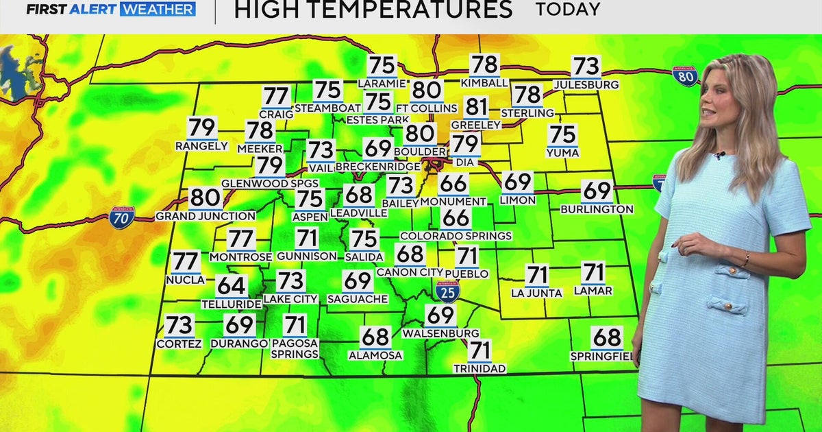
Fall is arriving across much of the country this weekend with a mix of pleasant conditions and regional surprises. CBS News reports a warm, dry pattern for Denver and Colorado, while KCTV5 forecasts beautiful fall-like conditions in the Kansas City area. But some regions face sharp swings — WLKY warns of soggy Friday weather followed by falling temperatures, and AccuWeather meteorologists predict drier conditions could trigger earlier-than-usual peak foliage colors in Colorado and New Mexico, while persistent clouds and rain may keep leaves green longer in the Southeast.
Siouxland residents are experiencing a rare seasonal shift. Sioux City hasn't recorded temperatures in the 40s since June 20 or in the 30s since May 20, making the forecast overnight lows in the upper 30s to low 40s a notable change. KVOA reports breezy conditions Saturday with winds easing Sunday, and highs near 70 Saturday staying in the upper 60s to near 70 Sunday.
Siouxland's First Cool Nights in Months
After nearly four months without single-digit temperatures, Siouxland enters a new season. KCRG reports that after recent heavy rainfall, dry conditions and plenty of sunshine are expected throughout the weekend and early next week. Temperatures will remain warm and dry, marking a shift from the summer heat that has dominated the region since late spring.
Indiana Braces for Rapid Weather Swings
West-central Indiana will see dramatic temperature and weather changes in just 24 hours. Highs are forecast to reach the mid-80s before a cold front arrives overnight. By Friday, highs will plummet into the 60s with heavy rain and thunderstorms possible, clearing by afternoon to leave cooler, drier weather behind.
Colorado's Dry Pattern Favors Harvest Season
Extended dry conditions across Colorado and New Mexico could speed up fall foliage this year. CBS News reports a warm, dry pattern for Denver and Colorado through the weekend, creating ideal conditions for harvest work. Drier weather typically brings sharper temperature swings between day and night, which triggers earlier color changes in trees.
Southeast Faces Muted Colors From Persistent Rain
While the West prepares for vibrant foliage, the Southeast will see duller fall colors this year. AccuWeather meteorologist Paul Pastelok said persistent clouds and rain will "keep the leaves green until leaf drop in the Southeast." He attributed the muted colors to a lack of clear nights and cooler air. Without sharp temperature drops and sunny days, leaves won't develop their brilliant reds and oranges.
Sentiment
Mostly NegativeNEGATIVENEUTRALPOSITIVE
Publishers
158
Articles
56
Reach
214
A
AnonymousAuthor


