Gulf Tropical System Forecast
Disorganized Gulf Low-Pressure System Could Develop Into Tropical Storm This Week
Anonymous
Key Points
1
The National Hurricane Center outlook cited a 60% chance of development within two days and an 80% chance within seven days, according to WDAM.
2
A separate Gulf Coast forecast put the system’s seven-day development chance at 50% and said the chance of it becoming a hurricane appeared low.
3
Coastal Alabama and northwest Florida could see anything from a very wet, breezy weekend to considerably less weather, depending on the low’s eventual development and track.
4
For Central Alabama, the forecast called for rain chances to rise Saturday and Sunday, with highs falling from the mid-to-upper 80s Friday to the upper 70s and low 80s over the weekend; lingering showers could continue into early next week.
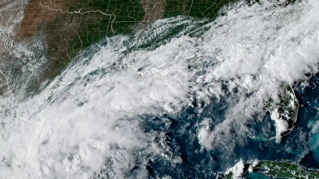
A disorganized low-pressure system in the southwestern Gulf of Mexico could strengthen into a tropical depression or storm by week's end, though forecasters remain uncertain about its final track and strength. The National Hurricane Center placed the system at a 60% chance of development within two days and 80% within seven days, while other Gulf Coast forecasters put seven-day odds at 50%, with hurricane development appearing unlikely.
Heavy rain poses the main threat to the Gulf Coast this weekend. Central Alabama, coastal areas, and northwest Florida could see anything from a very wet, breezy weekend to much less rainfall—it all depends on where the system goes and whether it actually develops into a tropical system.
System Could Become Tropical Storm by Friday
The National Hurricane Center designated the system Invest 92-L, marking it for formal watch. Strong wind shear in the region may limit how much the system strengthens, even if it does develop. KSLA News reported the storm is 'likely' to form this week, though development remains uncertain and not guaranteed.
Rain Expected Saturday and Sunday Across the Region
Central Alabama will see rain chances spike Saturday and Sunday as the system moves. Temperatures will drop from the mid-to-upper 80s on Friday down to the upper 70s and low 80s over the weekend. Lingering showers could continue into early next week before conditions improve.
Coastal Alabama and northwest Florida face the highest uncertainty. Depending on the system's exact path and strength, these areas could experience anything from heavy rain and gusty winds to relatively dry, calm conditions. Forecasters recommend monitoring updates closely through the week.
Drier Weather Returns Tuesday Through Thursday
After lingering showers fade early next week, much of the region will turn noticeably drier and sunnier from Tuesday through Thursday. The window represents a break before the weekend system arrives, giving residents a few days of clearer skies and more typical early-week weather patterns.
Sentiment
Mostly NegativeNEGATIVENEUTRALPOSITIVE
Publishers
13
Articles
9
Reach
22
Topics
A
AnonymousAuthor


