Flooding Threatens Multiple States
Severe Storms and Heavy Rain Threaten the Midwest and South Florida With Flooding
Anonymous
Key Points
1
The southern Wisconsin flood watch is scheduled from 1 a.m. Saturday, Sept. 19, through Saturday afternoon and covers 20 counties, including Dane, Milwaukee, Racine, Rock and Waukesha.
2
The National Weather Service warned that repeated storms could produce 3 to 6 inches of rain or more in some southern Wisconsin locations, while storm drains and ditches could become clogged with debris.
3
A Fort Lauderdale resident, Danielle Jacobson, said floodwater rose to the point that it was nearly entering her home after a neighbor urged her to install a floodgate: “The water was literally about to come in the door.”
4
In Broward County, flooding forced pedestrians to wade barefoot through water on Las Olas Boulevard, surrounded vehicles in a parking garage and left one stalled vehicle requiring a tow.
5
West Michigan could see additional rain Sunday and Monday, but the wetter pattern is expected to depart Tuesday as much colder air arrives with the autumnal equinox, which occurs at 8:05 p.m. that day.
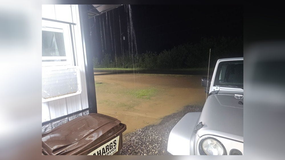
A massive storm system is dumping heavy rain across the Midwest and South Florida, with flooding threatening homes, roads, and airports from Wisconsin to New York. National Weather Service issued flood watches across 20 Wisconsin counties as southeastern Minnesota and northeastern Iowa brace for up to 7 inches of rain in narrow corridors. In Broward County, Florida, intense thunderstorms have already turned streets into rivers, stranding vehicles and forcing residents to protect their homes from rising floodwater.
The same storm system already caused damage farther west and south. In New Mexico, a sinkhole opened on U.S. 70 after flooding, while Phoenix residents required emergency rescues from stranded vehicles. CBS News reported that Fort Lauderdale-Hollywood International Airport experienced flight delays as Broward County streets flooded rapidly. Forecasters warn that repeated storm bands could overwhelm drainage systems in major cities including Chicago and New York through the weekend.
South Florida Battles Intense Street Flooding
Heavy thunderstorms turned Broward County roads into rushing waterways on Friday, forcing pedestrians to wade barefoot through floodwater. CBS News reported that vehicles sat surrounded by water in parking garages while stranded cars required towing from flooded streets. The Fort Lauderdale-Hollywood International Airport saw flight delays as the downpour intensified across the county.
Residents faced scary moments as water rose dangerously close to their homes. Danielle Jacobson, a Fort Lauderdale resident, said her neighbor warned her to install a floodgate: "The water was literally about to come in the door." Another longtime resident, Scot Piglia, acknowledged that the city is installing new storm drains but acknowledged they "just haven't gotten this far" into his neighborhood yet.
Wisconsin Braces for 3 to 6 Inches in Flood-Watch Counties
A flood watch covering 20 Wisconsin counties — including Milwaukee, Dane, Waukesha, Rock, and Racine — takes effect Saturday at 1 a.m. and lasts through Saturday afternoon. National Weather Service warned that southern Wisconsin could see 1 to 3 inches widespread, with isolated areas receiving 3 to 6 inches or more. Storm drains and ditches risk becoming clogged with debris, overwhelming the region's drainage capacity.
The heaviest rain is expected to focus on southeastern Minnesota and northeastern Iowa, where forecasters predict up to 7 inches in narrow corridors. The moisture-laden storm system is moving slowly eastward, meaning the heavy rain will persist through the day. Cities from Chicago to the Northeast could face flooding in poor-drainage areas and urban roads as the system shifts toward them.
West Michigan Faces Weekend Rain Before Cold Front Arrives
West Michigan will see its heaviest rain on Saturday, with 1.5 to 3 inches possible, according to WWMT. The forecast includes localized flooding and cooler temperatures as the system moves through. Additional rain is expected Sunday and Monday, but the wet pattern will depart sharply by Tuesday.
A dramatic weather shift arrives Tuesday evening when much colder air moves in, coinciding with the autumnal equinox at 8:05 p.m. EDT on September 22. The transition marks the end of the unusually wet pattern and the start of drier, colder autumn weather for the Midwest. Temperatures will drop noticeably as the cold front sweeps eastward.
Southwest Already Battered by Earlier Flooding
Before the Midwest and Florida were hit, severe flooding already damaged the Southwest and South-Central regions. In New Mexico, a sinkhole opened on U.S. 70 near Lordsburg after flood-induced erosion, forcing the road to close. In the Phoenix area, heavy downpours inundated roads and required emergency responders to execute water rescues for drivers stranded in their vehicles.
The repeated storms across multiple regions underscore the danger posed by "training" storms — multiple rain cells that repeatedly track over the same narrow corridors. National Weather Service officials warn that this pattern could produce dangerous accumulations and overwhelm infrastructure in vulnerable areas across the country.
Sentiment
Mostly NegativeNEGATIVENEUTRALPOSITIVE
Publishers
67
Articles
26
Reach
93
A
AnonymousAuthor


