Widespread U.S. Flood Threat
Heavy Rains and Flash Floods Threaten Multiple Regions Across the United States
Anonymous
Key Points
1
A flood watch was also in effect for most of the Chicago area through Thursday evening.
2
In Las Vegas and San Miguel County, the Gallinas River rose about 3½ feet in a day. Authorities closed El Camino, Cinder Road and Cunningham Road, and warned people to stay away from the river corridor.
3
NOAA’s Climate Prediction Center put the chance of a very strong El Niño in fall and winter 2026–27 at greater than 90 percent, a longer-range factor cited in the San Miguel County flood-preparedness report.
4
Colorado fire chief Bryan Ware said flooding near the Aspen Acres burn scar damaged dirt county roads so they were impassable to emergency equipment; he warned that just a few inches of water can make vehicle tires lose traction.
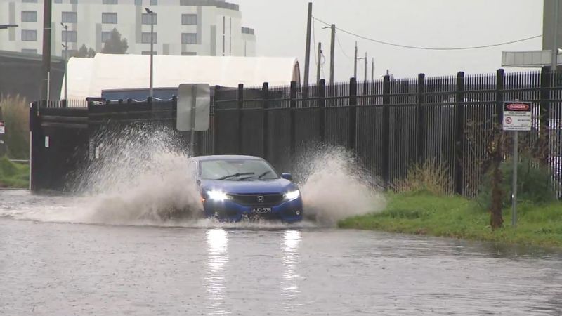
Heavy rain is threatening multiple U.S. regions from Texas to Colorado to the upper Midwest, with flash flooding already closing roads and forcing evacuation warnings. NBC Chicago reported a flood watch in effect for most of the Chicago area through Thursday evening, while FOX San Antonio warned of flooding across parts of Bexar County and the Hill Country late Thursday night into Friday morning. In New Mexico, the Gallinas River surged about 3.5 feet in just 24 hours, prompting authorities to close three major roads and urge residents to stay away from the river corridor.
The storms are hitting at a dangerous time. Burn scars from recent wildfires in Colorado and New Mexico make the soil unable to absorb water quickly. Rain that would normally soak into the ground now rushes downhill, creating sudden flash floods. Forecasters expect the heaviest rain to continue through Friday in Texas, Thursday in Kansas City, and into the weekend across the South.
Texas Storms Bring Flash Flood Risk to I-35 Corridor
Central and south Texas face overnight flash-flood threats as slow-moving storm cells park along Interstate 35. Forecasters warn that multiple thunderstorms could dump several inches of rain in the same spots. FOX San Antonio reported that flooding is already expected in low-lying areas and poor drainage zones. Wet roads are making commutes hazardous, and minor flooding has already begun in some neighborhoods.
Kansas City Faces Multiple Days of Heavy Rain
Kansas City will see repeated heavy downpours through Thursday, with widespread totals of 1 to 3 inches and some areas getting even more. Officials warn of flooding in low-lying areas and dangerous commutes during rush hour. The combination of wet roads and reduced visibility will make driving treacherous. Schools and businesses are urging residents to prepare for the worst-case scenario.
Burned Hillsides in Colorado and New Mexico Make Flooding Worse
Recent wildfires left Colorado and New Mexico's soil unable to absorb rainfall. Roads near the Aspen Acres burn scar in Colorado have already washed out, becoming impassable to emergency vehicles. Fire Chief Bryan Ware warned that "just a few inches of water can make vehicle tires lose traction," making escape difficult for stranded motorists. In San Miguel County, New Mexico, the Gallinas River rose 3.5 feet in one day after the 2022 Hermit's Peak/Calf Canyon Fire. Authorities closed El Camino, Cinder Road, and Cunningham Road due to flooding and urged people to stay away from the river corridor.
Tropical Moisture Brings Extended Rain to the South
The South will see increasingly frequent rain into the weekend as tropical moisture feeds into the region. Some areas could receive 2 to 4 inches or more, raising flood risks for communities already saturated from earlier storms. The combination of wet ground and heavy downpours means water has nowhere to go but into homes and onto roads. Emergency officials are urging residents to monitor alerts closely and avoid flooded waterways.
Sentiment
Mostly NegativeNEGATIVENEUTRALPOSITIVE
Publishers
27
Articles
14
Reach
41
A
AnonymousAuthor


